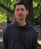
姓名: |
杨元维 |
性别: |
男 |
|
职称: |
副教授 |
学位: |
博士 |
|
Email: |
yyw_08@163.com |
邮编: |
430100 |
|
地址: |
湖北省武汉市蔡甸区蔡甸街大学路111号 |
|
|

|
更多信息: |
长江大学 地球科学学院地信系 个人更多信息:https://docs.qq.com/doc/p/76da31c6cda04500fe45b018397cd66127051a55?dver=3.0.27429706 |
简历:
杨元维,汉族。长江大学地球科学学院副教授、硕士生导师。面向轨道交通、智慧城市等检测、监测及数字孪生需求,主要从事计算机视觉、三维点云智能化处理、高分遥感影像解译、GIS工程应用。主持了省部级、厅局级项目5项,横向项目多项。发表相关学术论文40余篇,其中SCI收录10篇(第一/通讯作者20篇),授权中国发明专利2项。
研究方向:
铁路MLS点云场景语义分割。聚焦探索判别式、生成式语义网络分割网络在铁路MLS点云场景分割方法,设计小样本分割对象在网络中的显著特征表达,提升精度和效率。
工作及教育经历:
2003年09月-2007年06月,获湖北工程学院计算机科学与技术专业学士,导师夏红星教授;
2007年09月-2009年06月,获武汉大学遥感信息工程学院地图学与地理信息系统专业硕士,导师付仲良教授;
2009年06月-2010年09月,天津市地质工程勘察院,助理工程师;
2010年10月-2012年08月,武汉市房产信息中心,工程师;
2012年09月-2016年06月,获武汉大学遥感信息工程学院地图学与地理信息系统专业硕士,导师付仲良教授;
2016年06月-2022年01月,长江大学地球科学学院,讲师;
2022年2月至今,长江大学地球科学学院,副教授。
学术兼职:
国际地学、工程科学领域权威SCI期刊IEEE Transactions on Geoscience and Remote Sensing(TGRS)、International Journal of Applied Earth Observation and Geoinformation (JAG)、IEEE Sensors、IEEE Geoscience and Remote Sensing Society (J-STARS)、Remote Sensing等审稿人。
主讲课程:
《C#程序设计理论与实训》、《JAVA Web程序设计》、《GIS应用软件开发》。
近五年承担科研项目情况:
城市轨道交通数字化建设与测评技术国家工程实验室开放基金项目:基于点云数据的轨道交通接触网设施智能识别和提取关键技术研究,2021-2022,主持;
国交空间信息技术(北京)有限公司:河南省普通干线公路违建排查算法研究及示范区应用,2023-2023,主持。
获奖情况:
获奖人:杨元维,长江大学2022-2023学年度教学质量优秀,2023年。
指导学生参加大赛获奖
第十届全国大学生GIS应用技能大赛 一等奖 ,2021年
第九届全国大学生GIS应用技能大赛 二等奖 ,2020年
湖北省大学生GIS应用技能大赛 特等奖 省部级 2020年11月
中国高校计算机大赛微信小程序应用开发赛华中赛区 一等奖 教育部级 2019年
第一届“新起点 新征程”大学生微创大赛 一等奖 省部级 2017年
第三届“泰迪杯”数据分析职业技能大赛 二等奖 省部级 2020年
第十三届蓝桥杯全国软件和信息技术专业人才大赛全国总决 三等奖 2022年
中国高校计算机大赛微信小程序应用开发赛华中赛区 二等奖 教育部级 2018年
论文:(*为通讯作者,发表论文40余篇,一作或通讯20余篇)
1. Zhang yue, Yang yuanwei*, Gao xianjun. Robust extraction of multi-type support positioning devices in the catenary system of railway dataset based on MLS point clouds[J]. IEEE Transactions on Geoscience and Remote Sensing (TGRS). 2023. https://ieeexplore.ieee.org/document/10136738
2. Song huacui,Yang yuanwei*, Gao xianjun. Joint Classification of Hyperspectral and LiDAR Data Using Binary-Tree Transformer Network[J]. Remote Sensing, 2023, 15(11): 2706.(SCI 2区)
3. Guangbin Zhang, Xianjun Gao*, Jinhui Yang, Yuanwei Yang, Meilin Tan, Jie Xu, Yanjun Wang. A multi-task driven and reconfigurable network for cloud detection in cloud-snow coexistence regions from very-high-resolution remote sensing images. International Journal of Applied Earth Observation and Geoinformation(JAG). 2022, 114: 103070.(SCI 1区)https://doi.org/10.1016/j.jag.2022.103070
4. Gao xianjun, Yuanwei Yang. Two-stage Domain Adaption based on Image and Feature Levels for Cloud Detection in Cross-spatiotemporal Domain. IEEE Transactions on Geoscience and Remote Sensing (TGRS). 2024.(SCI 1区) https://ieeexplore.ieee.org/document/10439235
5. 杨元维,张跃,高贤君,马冰洁,郭申奥,许磊.顾及空间关系的3D LiDAR铁路支持装置自动提取[J].浙江大学学报(工学版),2022, 56(10): 2066-2076.(EI). https://kns.cnki.net/kcms/detail/detail.aspx?dbcode=CJFD&dbname=CJFDAUTO&filename=ZDZC202210018&uniplatform=NZKPT&v=HORr6DdPoD4zHYjnCMxlSvWZrN-g-mOVzoS0cIjpUrLnzWvg2uzl4vD_ona3SJiW
6. Xu Tao, Gao Xianjun,Yang Yuanwei*, et al. Construction of a Semantic Segmentation Network for the Overhead Catenary System Point Cloud Based on Multi-Scale Feature Fusion[J]. Remote Sensing. 2022, 14(12), 2768.(SCI 2区).https://doi.org/10.3390/rs14122768
7. Xu lei, Zheng Shunyi, Na Jiaming, Yang Yuanwei. A Vehicle-Borne Mobile Mapping System Based Framework for Semantic Segmentation and Modeling on Overhead Catenary System Using Deep Learning. Remote Sensing. 2022,13(23):4939.(SCI 2区). https://doi.org/10.3390/rs13234939
8. Xu lei, Gong jian, Na Jiaming, Yang Yuanwei. Shield Tunnel Convergence Diameter Detection Based on Self-Driven Mobile Laser Scanning. Remote Sensing. 2022,14(3):767.(SCI 2区). https://doi.org/10.3390/rs14030767
9. Zhang Guangbin, Gao Xianjun*,Yang Yuanwei, Wang Mingwei, Ran Shuhao. Controllably Deep Supervision and Multi-Scale Feature Fusion Network for Cloud and Snow Detection Based on Medium- and High-Resolution Imagery Dataset. Remote Sensing. 2021, 13, 4805.(SCI 2区).
10. Chang Jingxin, Gao Xianjun*, Yang Yuanwei, et al. Object-Oriented Building Contour Optimization Methodology for Image Classification Results via Generalized Gradient Vector Flow Snake Model[J]. Remote Sensing, 2021, 13(12): 2406.(SCI 2区). https://doi.org/10.3390/rs13122406
11. Ran Shuhao, Gao Xianjun, Yang Yuanwei*, et al. Building Multi-Feature Fusion Refined Network for Building Extraction from High-Resolution Remote Sensing Images[J]. Remote Sensing, 2021, 13(14): 2794. (SCI 2区). https://doi.org/10.3390/rs13142794
12. Yang Yuanwei , Ran Shuhao , Gao Xianjun* , et al. An Automatic Shadow Compensation Method via a New Model Combined Wallis Filter with LCC Model in High Resolution Remote Sensing Images[J]. Applied Sciences, 2020, 10(17):5799.(SCI3区). https://doi.org/10.3390/app10175799
13. Gao Xianjun, Wang Mingwei, Yang Yuanwei*, et al. Building Extraction from RGB VHR Images using Shifted Shadow Algorithm[J]. IEEE Access, 2018, PP(99):1-1.(SCI 2区). https://doi.org/10.1109/ACCESS.2018.2819705
14. 高贤君,郑学东,刘子潇,杨元维*,基于偏移阴影分析的高分可见光影像建筑物自动提取,光学学报,2017.1.20,37(4):315~324(EI). https://doi.org/10.3788/AOS201737.0428002
15. 高贤君,万幼川,杨元维*,何培培,高分辨率遥感影像阴影的自动检测与自动补偿,自动化学报,2014.8.15,40(08):1709~1720(EI). http://www.aas.net.cn/cn/article/doi/10.3724/SP.J.1004.2014.01709
16. 冉树浩,胡玉龙, 杨元维*.基于样本形态变换的高分遥感影像建筑物提取[J].浙江大学学报(工学版),2020,54(05):996-1006.(EI) http://www.zjujournals.com/eng/CN/10.3785/j.issn.1008-973X.2020.05.018
17. 常京新, 王双喜, 杨元维*,等. 高分遥感影像建筑物轮廓的逐级优化方法[J]. 中国激光, 2020, 47(10):14.(EI). https://kns.cnki.net/KCMS/detail/detail.aspx?dbcode=CJFD&filename=JJZZ202010030
18. 王双喜,杨元维*,常京新,高贤君.高分辨率影像分类提取建筑物轮廓的优化方法[J].激光与光电子学进展,2020,57(02):329-338. https://kns.cnki.net/kcms/detail/detail.aspx?dbcode=CJFD&dbname=CJFDLAST2020&filename=JGDJ202002037&uniplatform=NZKPT&v=V02iphVXMCC47KGHIS2Fvzq8J4_KGToDnsuqrxsnHcWdTfdVt33C1qr5WLDTQgXi
19. 周宁,杨元维*,王萍,高贤君,方军.基于GCP的大规模无人机影像检索方法[J].遥感信息,2021,36(02):136-144. https://kns.cnki.net/kcms/detail/detail.aspx?dbcode=CJFD&dbname=CJFDLAST2021&filename=YGXX202102021&uniplatform=NZKPT&v=c20U0pKOjTwdejCUBDcRFVOFor3HzOrRYPy6FlmwFreqqyDT0H0d3JN-oTYxMxCn
20. 李鹏,杨元维*,高贤君.基于双向循环神经网络的汉语语音识别[J].应用声学,2020,39(03):464-471. https://kns.cnki.net/kcms/detail/detail.aspx?dbcode=CJFD&dbname=CJFDLAST2020&filename=YYSN202003020&uniplatform=NZKPT&v=xPP5kPE1ilVaPr2YOCeG_BslPxoHQWG9pmSl5dgt8Lv5qo1IU5V465W0kI94euNm
专利:
1. 杨元维,高贤君,李功权,冉树浩,常京新,李熙. 一种改进的Wallis阴影自动补偿方法及装置,ZL201910588209.7, 授权日期:2023年3月17日。
2. 杨元维,冉树浩,高贤君,陈明珠. 基于偏移阴影样本形态变换的高分遥感影像建筑物提取方法,ZL201910983850.0, 授权日期:2023年4月21日。

